St Pauls
St James is a medieval parish that originally covered the land owned by the Priory to the north of the River Frome. Most of this was agricultural land, but by the end of the 1700s the population in Bristol was starting to increase and gradually streets and houses were being built on former farmland around the edge of the city.
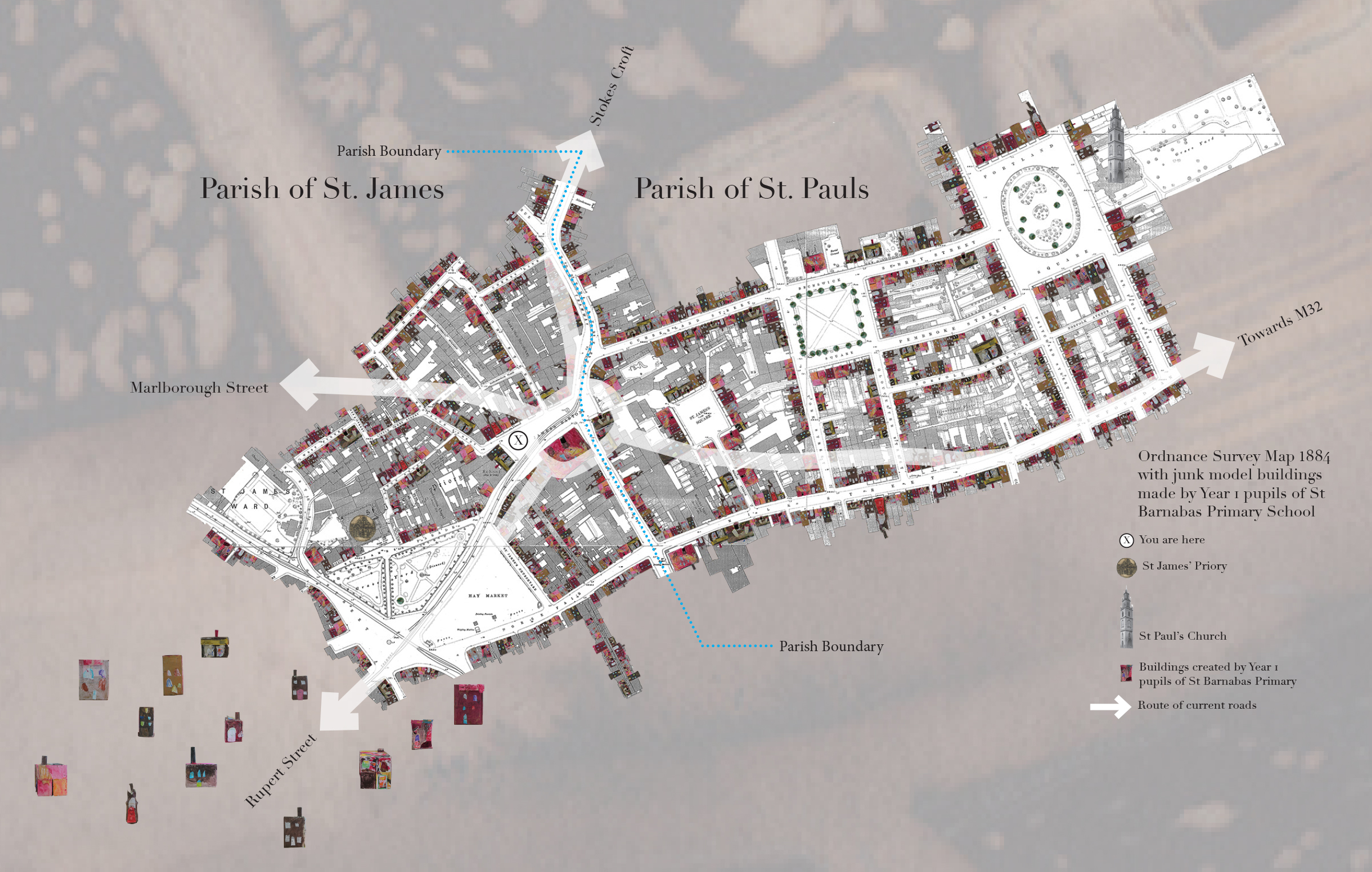
Eventually the population of St James parish had become too large for the priory church so in 1790 the parish was split in to two with the land to the east of Stokes Croft where much of the new housing was being built becoming the new parish of St Pauls. A new church was built in the early 1790s as part of the development of Portland Square.
The boundary of this parish from 1790 is shown on many old maps like the 1880s map used on the Bearpit panels. This boundary ran right through the middle of what is now the Bearpit roundabout and continued down Barr Street that is now the middle of Debenhams.